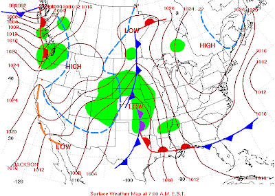
Thursday, December 31, 2009

FCST: 01/02-03/10 Hint of Snow for NW MO

Edit 0615Z/4: Here are the snowfall totals from several disturbances that moved through the local area over the weekend as reported to the NWS EAX:


EAX reported snowfall totals

OLD BLOG ENTRY: The GFS is hinting at a potential 2" to 4" snowfall Saturday into Sunday.  The NAM takes the snow to the west in central Kansas.  This is a weak disturbance locked up in the NWLY flow and is not going to have a major impact on the local area.  However, it may be enough of a nuisance to impact some weekend travel in the local area.


Wednesday, December 30, 2009

FCST: 12/30-31/09 FLASH FREEZE--NW MO

An artic front is forecasted to blast through the local area around midnight tonight.  This is going to cause a flash freeze which will create dangerous driving conditions in the NW MO area.  The arctic front should enter the NW corner of MO between 9 p.m. and 10 p.m. and reach the Cameron area by midnight.  The NWS in Pleasant Hill has issued a special weather statement highlighting this dangerous situation.  Visit www.crh.noaa.gov/eax for more information. ~ CS


Frontal position and METARS as of 7:30 p.m. December 30, 2009

Sunday, December 27, 2009

FCST: 12/29-30/09 SNOW--NW MO

EDIT: 29/3Z  Snow is moving in from the southwest this evening.  Not expecting much accumulation from this weak disturbance, maybe 1" to 2" tops for the local area.  We have chance of snow during the day Wednesday as well, little to any additional accumulation.  Another chance of snow enters the forecast over the weekend with a chance of light accumulations.  The bigger story comes the weekend after next where a larger storm system is beginning to show up on the models!  Just in time for the SKEW-T / Hodograph class in Cameron, YEAH!


If you are a believer in long wave patterns recurring during a set time frame (my thoughts are 58 to 62 days this year) then it is no suprise we have a chance of snow in the Tuesday into Wednesday time frame.   For more info on long wave patterns visit http://www.lrcweather.com/.

This is not a major storm but enough to produce accumulating snow in the 2" to 4" range for the local area based on current model data.  Here is a look back at the October 29, 2009 storm that moved through our area:


I expect this storm to track to the south and east of the local area due to the position of the southern jet and cold air in place.  There is no doubt the precipitation will be all snow with this system.  It moved through fairly quick in October and dropped between 0.10 and 0.20 of precipiation.  Will the storm track further south and east?  Will the storm slow down this time and procude more precipiation in the local area?  Watch the blog as we track the system toward mid-week! ~ CS

We are also currently working on our new storm chasing media website, http://www.mesoextrememedia.com/.  It is in the development stages and we hope to have it up and fully operational by February 2010.  Check back often as we develop the site!

Friday, December 25, 2009

Blizzard Recap by EAX Staff

Here is a link to the Christmas Eve and Christmas Day Blizzard of 2009.  This page covers the event very well.  The staff at EAX was a great asset and partner during this event.  My hats off to them! ~ CS

http://www.crh.noaa.gov/eax/?n=2009dec2425blizzard

Tuesday, December 22, 2009

FCST: 12/23-24/09 Snow NW MO and NE KS

EDIT 0530Z/23: The 0Z runs of the NAM and GFS are in and they are much more impressive and bullish with their snow totals.  Steve and I have been looking at the models all evening trying to figure out our best forecast to put up on the blog.  We are going to stick with 3" to 6" right now, with the heaviest falling late Thursday evening into the overnight hours.  We could locally see some 8" amounts if the ULL tracks as the models suggest.  If the ULL tracks further S and E and the secondary low takes over as the dominant low we could see A LOT more snow locally.  The secondary low that forms over AR intensifies as it moves up along the MO and IL borders.  The pressure gradient also increases dramatically as the ULL's pull off to the north and east.  This pressure gradient tightness will bring strong, gusty winds into the local area which COULD produce near whiteout or blizzard conditions Thursday night!  Please keep abreast of the latest NWS forecasts for watches and warnings as this is a significant storm system!  Currently KEAX has no watches issued, but I anticipate some sort of headline by tomorrow morning as long as the model runs stay consistent and surface/upper air obs are supporting snow/ice crystal formation! ~ CS


WOW, what a storm to watch and try to amateur forecast...this has been a learning experience to say the least....I still see the probability of at least two ULL and a shortwave from the NW impacting our weather over the Christmas holiday.....I do think we will have a dominant low that the others will interact with to give us a winter weather event here locally.......


Forecasted Low Surface Tracks

The storm system has entered the sounding network and the models have had a couple of runs with "real" data to work with"  My current thinking is the ULL is going to track a bit further south and east, which has been my concern all along.  During the winter months it is very difficult to get a low to track as far north as the models have been predicting.  This is due to cold air intrusion and the position of the southern jet stream.  There is some consistency to the models now and they are coming into better agreement.

This being said I believe the heavier snow totals are going to be pulled further south and east than previously forecasted.  I do believe NC KS, SC NE and NW IA are going to see the heaviest snow totals from this storm, some areas may see up to 18" of snow.  My current thought around here is quite a bit less...maybe in the 3" to 6" range.  However, if the QPF is not being overdone by the models we could get quite a bit more.  It all depends on the track of the ULL, the speed of the ULL and if the low intensifies. 

Here are my forecast reasonings:
1000-500 and 850-700 mb freezing line is east of us now earlier than anticipated,
1000-500 mb RH greater than 90% and dry air intrusion remains east of the local area,
Warmest Vertical Temp and 850 mb freeze line is also east of us now,
ULL is tracking to our south and east (not sure how far right now though),
ULL slows down and intensifies as it moves off to the northeast,
Heaviest snow to fall north and west of the track of the ULL,
Long duration snow event is in store.

Timing of the precip:
A cold rain will rapidly change to snow during the late afternoon hours on Thursday.  Snow will continue, moderate at times, during the overnight hours into Friday morning. Heaviest snow should fall between 9 p.m. and midnight.  Strong winds will accompany the snow and we could have whiteout to near blizzard conditions making travel nearly impossible during the overnight hours on Thursday.

More later this evening as I get a chance to look at this evenings model data. ~ CS

Monday, December 21, 2009

FCST: 12/23-25/2009 Winter Wx Event--Central Plains / Upper Midwest

Hmmmmmm.....where is spring at?  This storm has so much potential but just not for the local area!  Sounds like a broken record from the spring of 2009 doesn't it!  Simple facts:

ULL tracks northwest of the local area,
Freeze line stays northwest of the local area until late Thursday;
QPF is unbelievable, literally, for this storm;
We could get some wrap around snow accumulations from the storm late Thursday into Friday,
Possibly a white Christmas with a couple inches on the ground;
It is going to get colder and there will be some decent wind as the storm pulls out to the north and northeast!

Ok...there are my forecast thoughts on the current track of most models!  Now the caveat:  if the ULL track does not follow the model forecasts and shifts a hundred miles or so south we get some decent snows as it will bring the freezing line and heavier precip closer to us!  The storm is entering the sounding network in the Pacific Northwest now.  This will give us some real time data to look at that will solidify the track a "little" bit better.  We are still 3 to 4 days away from this event so all forecasts need to be watched very closely!  The latest model data is filtering in now and I will be looking at it late this evening! ~ CS

Sunday, December 20, 2009

FCST: 12/23-25/09 Winter Wx Event--Central Plains


HPC Surface Forecast 12Z December 24, 2009
(Places ULL in SW MO)

HPC Surface Forecast 12Z December 25, 2009
(Places ULL in SE IA)

EDIT 6Z/21: Latest data rolled in earlier this evening and the models are still not coming into "total" agreement. GFS has moved a bit further south than the previous run (back toward earlier runs), while the ECMWF, UKMET and GEM are still farther north and west with their tracks (somewhat consistent). 

Some of the models are slowing the system down and letting it dig in the desert southwest before it kicks out into the plains, making this a late Wednesday night through Christmas event.  A lot of inconsistencies, as has been the case the last few days, to try to pin down a track this early.  You also need to keep in mind this storm system is just entering the sampling network in the Pacific Northwest.


EMCWF Model Forecast valid 12Z December 24, 2009
(Places the ULL in SE KS)


GFS Model Forecast valid 12Z December 24, 2009
(Places the ULL in SE KS / NE OK)


GEM Model Forecast Valid 12Z December 24, 2009
(Places the ULL in SW IA)

Here is a look at some of the past 24 hour GFS run storm track outputs. Pay attention to the storm tracks from the south/southwest (Oklahoma and Arkansas area) as this is our storm:


Once we get some get sampling data on the storm and get closer to the event it is going to be a "little" easier to pin down the track of the upper level low. A secondary low is also showing up on some model runs and trying to phase with the main system as it ejects northeast of the local area. This may leave some lingering snow showers into Saturday. Way to early to talk accumulations and if you see any forecasts it is a "best guess" or wishcasting scenario at best. A freezing rain event is in the back of my mind as well, but not the classical set up for a crippling ice storm due to no cold air at the surface. If we do get ice, it will be light in nature and more of a nuisance to travel than anything. Albeit, it is occurring during the Christmas holiday travel period.

Winter forecasting is always difficult and highly dependent on the track of the upper level low. Now factor a few variable surface parameters into the equation and WOW!  We have no artic or even cold air for that matter in place.  Add in the warm air advection (WAA) with the moisture transport from the Gulf of Mexico and it really muddies things up.

 The 1000-500mb thickness (540dam), 850mb 0C and Warmest Vertical Temp 0C lines remains north and west of the Cameron (4-county area) for most of this event. If this were to hold true, any frozen precip that falls will be well north and west of the local area leaving us with all liquid precipitation.  The overnight hours would be the only concern for me right now for freezing drizzle / freezing rain as the surface temps drop below freezing and the 850mb temps remain above freezing.

Here is a basic ULL track for us to get heavy snow:  The ULL would need to roughly track near Fort Smith, AR and turn north/northeast and track between Columbia and St. Louis, MO. The more time it takes the ULL to follow this track the more prolonged our snow event will be and the more accumulation we would receive. In addition, the atmospheric column and surface/near surface temps have to be cold enough to support snow.

A lot of stuff to think about and digest for sure!!  More tomorrow after I have the chance to look at some more data and get a chance to look at some surface parameters as the storm is moving inland! ~ CS

Saturday, December 19, 2009

FCST: 12/23-25/2009 Winter Wx Event--Central Plains / Svr Storms Gulf Coast States


5 Day surface map forecast--Issued 1843Z/19

EDIT (17Z/20): Several of the computer models are forecasting a more northerly track for this storm system, which would put the heaviest snows across IA, southern MN and into WI.  The ECMWF has been trending this way for a couple of runs now and the GEM and GFS went this way last night.  I still want to see some model consistency from run to run on all of the operational models.  Right now the low tracks through SE KS through Central MO and into SE IA by Thursday morning.  The heaviest snows will fall and north and west of the track of the low.  This is why forecasting winter storms this far out is not wise and not more than a guess based on what one computer model thinks is going to happen.  The data used is only as good as the data entered.  However, one thing to keep in mind is the jet stream is stronger and further south in the winter, so this could impact how far north the track of the ULL will be.  I will be looking at the 18Z data shortly for consistency from run to run.  This may not occur until the storm system comes onto the west coast and we get some good sampling data! 

Forecast thoughts ATTM: I am still thinking precip breaks out late Tuesday into Wednesday and beings as light freezing rain and/or freezing  drizzle (all depening on the thermal profile of the column).  During the day Wednesday I look for the precip to transition to all rain as warm air is advected north.  I do not expect the rain to transition to snow until Wednesday night as cold air is pulled into the system as the system moves by to the north and east.

Some parts of the Upper Mississippi Valley are going to see a lot of snow.  I am watching the 850mb temp line very close as there is a very slim chance this could be a freezing rain event for us, at least during the early periods. 


SWODY4

Severe weather remains a possibility over the Gulf Coast States.  I anticipate severe weather from E. TX to LA to MS during this event.  SPC has it marked for the Day 4 period. ~ CS


Old Discussion
A major winter storm is taking shape, per forecast models, to affect the central plains beginning as early as Tuesday night and lasting through Thursday.  My current thinking is this storm will start off as light rain/snow mix Tuesday night and transition to all snow by Wednesday with a possible long duration snow event for someone in the central plains.  The 12Z/19 GFS paints the heaviest snow totals over Northern MO and Southern IA, however, the models have been very inconsistent and I am not willing to bite the forecasted track just yet.

It is way to early to talk accumulations but someone within 200 miles of our local area is going to have a white Christmas, VERY NICE!  Pay attention to local NWS forecasts as this storm is going to hit during the big holiday travel period.

In addition a severe weather outbreak is possible across east TX, LA and MS during the same time period.  December (winter) severe weather outbreaks are more danagerous than spring as people are more complacent and think severe thunderstorms are not possible!  If you have friends and family in the above described areas please ask them to pay attention to NWS forecasts and local commercial media outlets as this storm system unfolds next week!

In the meantime, I am going to be looking at this more closely this weekend and will post more info by Sunday night!  Have a great weekend!  ~ CS

Monday, December 7, 2009

FCST: 12/7-9/09 Winter Storm--NE KS & NW MO


The National Weather Service in Pleasant Hill has issued  Winter Storm warning for all of NE KS and NW MO from midnight Tuesday December 8 until 6 a.m. Wednesday December 9.  Snow, moderate to heavy at times, is forecasted to fall beginning at midnight Tuesday and lasting through early Wednesday morning.  Snowfall rates during the peak of the storm may meet or exceed 2" per hour.  In addition, sustained winds of 20 to 30 mph with locally higher gusts are expected late Tuesday afternoon into the overnight hours.  Whiteout to near blizzard conditions are possible in the warning area.  Travel will become hazardous if not impossible tomorrow afternoon into the overnight hours.

Temperatures are also going to tumble with highs Wednesday only in the teens with wind chills below zero.  Lows Wednesday night will be the coldest of this fall season bottoming our near 0 with wind chill values in the teens below zero.  ~ CS

EDIT: I am a bit concerned that the track of the ULL is going to be a bit further south than initially forecasted.  If this occurs, the heavier snow totals will be in the Cameron and 4 county area.  Will know more later as the new models just started coming in the last few hours. Models are picking up on some drier are being pulled into the system during the day tomorrow....this is common for snow storms in the Midwest...this really limits the snow totals and makes it very hard to forecast accumulations....will see if the models are right on the dry air intrusion as the event unfolds....needless to say a very difficult forecast indeed. ~ CS

Thursday, December 3, 2009

FCST: Winter Weather Event 12/8-9/09

Target Area: NW MO and NE KS WInter Wx Event

Forecast Discussion: Stay tuned to the blog as the models are showing a very potent winter storm possible for NW MO and NE KS beginning as early as Monday night and lasting into Wednesday.  The potential looks good ATTM for a significant winter weather event in our local area.

Chase Summary: